 Show on map
Oxgang Bridge was on what is now Plantation Road and is marked on every Ordnance Survey map since the first edition, it is where Roger Dyke / West Dyke passes under the road between Marske and Kirkleatham.

I took these photos on an evening in 2007 in poor light and always intended to get better photo and find out something more about the bridge, at this point just the sides of the bridge were visible.
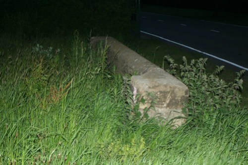
Since that time the side have also been removed leaving no trace of the bridge, although presumably the rest of the structure is still buried under the road.
Also of interest is the Fever Hospital and mortuary just upstream which is now the site of the Grewgrass Lodges
Stones removed for official reasons or stolen?
I think they would have been pretty tricky to pinch. Presumably removed for ‘safety’ reasons.
A pedant asks; Given that ‘Oxgang’ stands for an old Norse land measurement (c 20 acres, I think) the name must be pretty venerable. Do anyone have knowledge of this area of land and its history ?