Hammer and Hand, Hutton-le-Hole

Geotag Icon Show on map

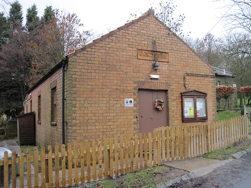
The Hammer and Hand was once and inn and is dated 1784 on its date-stone.
Hammer and Hand. Hutton-le-Hole
The initials: E B S are for Emmanuel and Betty Strickland, landlords of the Hammer and Hand.
Hammer and Hand. Hutton-le-Hole
The panel carries the inscription “By hammer and hand all arts do stand”.

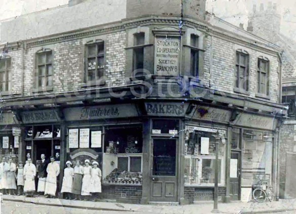
Stockton Co-operative Branch No.8 – Norton

Geotag Icon Show on map

The sign for No.8 branch of the Stockton Co-operative became visible again during recent work. Thanks to Wayne Martin for getting me the shots.
DSC_2497 DSC_2496
Old photos of the same location can be found on the Picture Stockton Archive

‘Lucy Oxford’ box, Kirklevington

Geotag Icon Show on map

This old green box carries the inscripton “Lucy Oxford”. William Lucy renamed the Eagle Ironworks after himself in 1873. In the late 1880s they diversified into electrical products, Lucy Switchgear is still in business today.
'Lucy Box' Kirklevington
This is what they would call a service pillar and it may be related to street lighting or telephones in the area, I suspect there are still a lot about although most are more modern versions than this one.
'Lucy Box' Kirklevington

Sinnington Flood Bridge

Geotag Icon Show on map

Sinnington Flood Bridge originally dates from 1769 with a rebuild in 1794.
Sinnington Bridge
It was originally used to cross a flood channel for the River Seven, which has long since silted up.
Sinnington Bridge
It was restored to its current state in 1966

Manor House, Stokesley

Geotag Icon Show on map

Manor House in Stokesley was built to two stages in the 18th and 19th century.
Stokesley Manor House
It was once a hospital, public library and court house, but has more recently become a private home again.
Stokesley Manor House
The gate piers come from Angrove Hall, which was between Great Ayton and Stokesley and was demolished in 1832.
Stokesley Manor House

Preston School, Stokesley 1832

Geotag Icon Show on map

Preston Grammar School in Stokesley dates 1832
Preston School, Stokesley 1832
John Preston was a local attorney who died in 1814 leaving £2000 to establish a school, however a long a protracted legal battle followed about other parts of the will.
Preston School, Stokesley
The school was opened in 1832 by Archdeacon Harcourt with Rev T Todd appointed as headmaster
Preston School, Stokesley 1832

It remained a school until 1908 and is now the first time a pizza shop has appeared on this website.

Old Weir / Fish Ponds – Kildale

Geotag Icon Show on map

In the woods just to the North of Kildale are the remains of a large weir.
Ruined Weir, Kildale

Ruined Weir, Kildale
The first OS Map from 1856 and subsequent editions marks this area as “Old Fish Ponds”
1894
A great flood is recorded to have taken place in Kildale in 1840 by the breaking of a dam at Kildale Hall.
1840
Although I cannot say for sure, this seems the likely the location of that event as the river now flows to the North around the old weir.

Alfred Crossley Memorial Institute, Commondale

Geotag Icon Show on map

The Cleveland Firebrick and Pottery Company was founded in Commondale by John Slater Pratt and operated under many names and owners all the way until 1947.
Alfred Crosley Institute, Commondale
The Crossley family owned the brickworks on more than one occasion and have a strong association with the village.
Alfred Crosley Institute, Commondale
The memorial institute dates from 1923, although the gravestone shows that Alfred actually died in 1919.
St Peters Commondale

C1268 Sign, Upleatham

Geotag Icon Show on map

Road signs for C-Roads are something of a rarity as they shouldn’t really exist. Nothing below a B-road is supposed to be named on signposts.
c-road
Generally if they exist its probably an administrative error, and here’s a local example.

1893 Mystery Stone, Loftus

Geotag Icon Show on map

This stone near the base of a wall on North Road bears the date 1893, I have no idea of its origins or if it came from another building.
1893 Stone, Loftus
Perhaps there was once a water trough like this other dated stone just near the Market Place.
1884 Trough, Loftus