Carlton / Redmarshall Station

Geotag Icon Show on map

Calton station opened in 1836 on the Clarence Railway, after various mergers it became part of the London and North Eastern Railway and was renamed Redmarshall Station in 1923.
Shildon to Newport Electric Railway
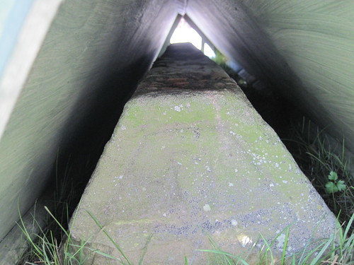
Two set of tracks existed here, with an early example of electrification taking place in 1915 for coal traffic on the line, two pair of lines passed under the bridge with the left-side being electrified, this portal is now filled and the track lifted.
Shildon to Newport Electric Railway
Perhaps this old insulator still on the bridge could be part of that system ?
Shildon to Newport Electric Railway
The LNER removed the electrification in 1935, however the guard rails on this side of the bridge still remain, giving extra protection that’s not included on the non-electric side.
Shildon to Newport Electric Railway

The passenger station itself closed on 31st March 1952

Pillboxes, Thorpe Thewles Viaduct

Geotag Icon Show on map

On either side of the Northern end of the demolished viaduct is a type 23 Pillbox.
The western one is on an accessible part of the walkway
Thorpe Thewles - Pillbox
The eastern example is in a private field, so no close-up.
Thorpe Thewles - Pillbox

Thorpe Thewles Viaduct Remains

Geotag Icon Show on map

The 1877/78 Thorpe Thewles viaduct was demolished spectacularly in 1979
Thorpe Thewles Viaduct Remains
This stone outside the village is part of the structure.
Thorpe Thewles Viaduct Remains
At the top of an embankment overlooking the village are a few scant remains of the viaduct
Thorpe Thewles Viaduct Remains

St. James Church, Thorpe Thewles

Geotag Icon Show on map

St James Church was built in 1886-7 on the site of the short lived Holy Trinity Church of 1848
Thorpe Thewles Church

The font outside is originally from St. Thomas a Becket’s church in Grindon.

Thorpe Thewles Church

Thorpe Thewles – Roger De Fulthorpe Grave Cover

Geotag Icon Show on map

This is one part of Teesside that’s remaining hidden at the moment, the grave cover is currently covered for its own protection.
Thorpe Thewles -  Roger De Fulthorpe Grave Cover
The stone was originally in St. Thomas a Becket’s church in Grindon
Thorpe Thewles -  Roger De Fulthorpe Gravecover

This photo from the Thorpe Thewles History Group shows a comparision betwen 1940 and 2007 and the rapid deterioration of the inscription.


The group are hoping to start a conservation project this year, so hopefully it will soon be on view again.

Thorpe Thewles Pillbox

Geotag Icon Show on map

This pillbox near the middle of the village is a variant on the Type-23 design
Thorpe Thewles - Pillbox
A doorway has been cut in the back, rather than it being accessed from above.
Thorpe Thewles - Pillbox
Pillboxes like this are often partially buried, so presumably the modification was to make access easier to this un-buried model.

St Thomas a Beckets Church, Grindon

Geotag Icon Show on map

Originally built in the 12th century, in use until 1848 when it was abandoned due to the opening of a new church in Thorpe Thewles (which was itself replaced in 1885 with the current church)
Grindon Church 1
Grindon Church 2
Grindon Church 6
Grindon Church 7