Hidden away behind the library, several rows of very uniform gravestones ranging from the 1850s through to the early 1900s.

 Show on map
 Hidden away behind the library, several rows of very uniform gravestones ranging from the 1850s through to the early 1900s.
Show on map The Zetland Club was hit by a bomb on 21st October 1941. Amongst the 15 killed were the mayor, councillors and a doctor. 
Alderman Charles Harris J.P.
Frank Bainbridge. (Builder)
John C.D. Barnett. (School Master)
William Crozier. (Bank Manager)
Mabel Fletcher. (Club Stewardess)
Charles H. Goodwin. (Optician)
Arthur Pickering J.P. (Chairman of the local magistrates)
Matthew Ranson (Retired School Master)
Doris R. Rigby. (Club Maid)
Dr. Alfred S. Robinson.
Joseph Roebuck. (Councillor)
William J. Smallwood. (Company Commercial Manger)
Doris Walton.
Harold Watson.
Marion Watson.

The garden of rememberance also has plaques for those lost at sea and Dunkirk.

Show on map I’ve had this scrap of paper that I bought from the lifeboat shop for at least 20 years, I’ve rewritten the legend but the rest is straight from the original.
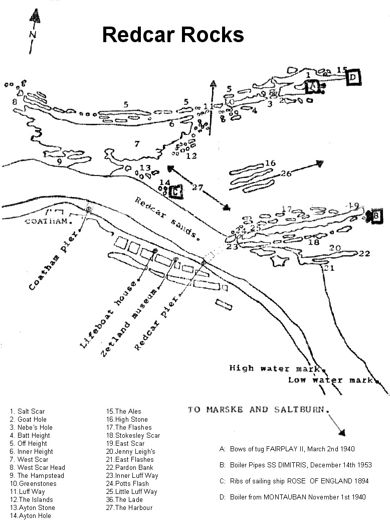
Show on map I’ve not yet found any record of the ships name, or date it was wrecked.


The remains of the ship can be seen depending on the tides and sand levels.


Show on map Built around 1916 to detect approaching Zeppelins, now sits surrounded by houses but safe due to being a scheduled ancient monument.

The base of the column where the listening trumpet was mounted is a few feet in front of the mirror.

Information on other Sound Mirrors in the UK can be found here
Show on map The shale heap is visible from miles around and a number of building survive on the ground.

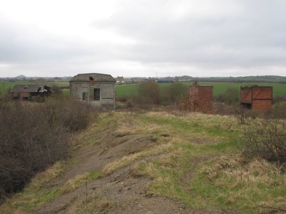


Although one building, possible a workshop is in danger of complete collapse.

The winder house is much more sturdy as its built from reinforced concrete, although in recent years the steps pictured have collapsed
Note: This substantial structure was subsequently demolished and is sadly no longer on the site

The capped 694ft shaft is also visible

In the side of a small shale heap is a small tunnel, perhaps some kind of shelter or storage area as this isn’t a drift mine.


Away in the woods to the east is a small building, I initially though it may be a powder magazine but its not very sturdy and a 1950s map shows a meter house for the Cleveland Water Company in this area.


Show on map In Dunsdale but known as the Kirkleatham mine. The entrance to the drift mine is open but the tunnel is filled/collapsed about 10 metres in. Old maps of the area also show a second tunnel running under the road slightly to the north (not for the stream) and a powder magazine but no trace of either can now be seen.


Show on map A 13th Century castle, but without the usual gift shop and tourist buses,nice bricked up 16th century Elizabethan mullioned windows. The castle was a ruin in 1309, habitable again in the Civil War when it was destroyed in 1647


The bridge is formed under a path to the entrance.

Show on map Part of the coastal line to Whitby, closed in the late 1950’s.
The 250m long tunnel is gently curved, still in very good condition internally and open at both end, the collapsed section is just a small side tunnel and may well just be back-filled escape tunnel.
You emerge on to a very overgrown trackbed on the cliffs edge, i’ll continue along to the Sandsend tunnel another day.


Show on map The only part of the Kirkleatham stables thats accessible. A few out buildings to the North West on the verge of complete collapse.


