Stockton – Billingham Boundary Marker. Mill Lane Wolviston

Geotag Icon Show on map

Many thanks to Peter Edwards for submitting this photo and location of historic boundary marker visible on Mill Lane between Wolviston and Billingham.

It marks the boundary between Stockton Rural District (1894-1974) and Billingham Urban District (1923 – 1968) The first OS mapping to include this boundary is dated 1939.

1939 6” map showing the boundary. The marker is in the western hedge of Mill Lane
Overlayed onto modern aerial mapping.

Billingham Beck passing under Railway

Geotag Icon Show on map

This impressive tunnel carries Billingham Beck under what was originally the Clarence Railway.

Billingham Beck

Not sure if this is the original 1830s construction or the bricks are later, there also seems to be a reinforcement or repair a short distance in on concrete.

Norton Water Mill – Tunnel

Geotag Icon Show on map

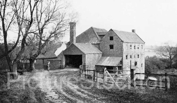
This tunnel carried the mill race for Norton Water Mill underneath the Clarence Railway embankment  that was built in the early 1830s. The modern railway still passes above.

Mill Race Tunnel, Norton Water Mill.

The mill itself stood about 500m South, now underneath the A19.

1949 Industrial Adverts, Middlesbrough / Darlington

First batch that I posted on Facebook this week, thought it a good idea to post them here too as not everyone uses Facebook and if it didn’t just happen you’ll never find it.

Gjers Mills & Co, Ayresome Ironworks, Middlesbrough
Gjers Mills & Co, Ayresome Ironworks 1949

Darlington Railway Plant & Foundry, Bank Top
Darlington Railway Plant & Foundary 1949

Davy and United, Roll Foundry, Billingham
Davy and United, Roll Foundry, Billingham / Middlesbrough 1949

River Tees Conservancy Commissioners
River Tees Conservancy Comission 1949

St Cuthberts, Billingham

Geotag Icon Show on map

Parts of the current tower are thought to date from around 1000 AD, a very through description of the buildings can be found here
St Cuthberts, Billingham
An Anglo-Saxon settlement existed in Billingham as far back as the 7th century, inhabited by early followers of Cuthbert
St Cuthberts, Billingham
Outside the church stands an attractive Lych Gate

Stockton Co-operative Society, Billingham

Geotag Icon Show on map

Despite its theatre/cinema looks this building was built as a department store for the Stockton Co-operative Society.
Stockton Co-operative Society, Billingham Stockton Co-operative Society, Billingham
The building is currently used as carpet shop, although the Billigham Players use the “Theatre Upstairs”
The building outline appears in its current form between the 1938 and 1939 editions of the OS map, although it could date from slightly earlier if the 1938 was already out of date.


I’ve found a reference to the nearby Heslops Brewey being sold to the Billingham Picture House Company in 1936 and demolished shortly afterwards, so suspect this whole area dates from around that time.

Picture House, Billingham

Geotag Icon Show on map

Externally the building is pretty much unchanged since this 1935 photo.
Picture House, Billingham
The building was recently an Indian restaurant but is currently being redeveloped by Fracture Theatre who also hope to show films there again.

Billingham Hall Lodge / Gatehouse

Geotag Icon Show on map

Billingham Hall was a Victorian Villa built around 1870 and demolished in 1935.
Billingham Hall, Lodge Billingham Hall, Lodge

The Hall itself is now under Connifer Crescent, but the gates and lodge reamain.

Granite Cross – Billingham Green

Geotag Icon Show on map

This Shap Granite cross was erected at a cost of £44 in 1893, the idea of Rev Phillip Rudd. It was made by Bowrons of Stockton.
Cross Bilingham Green
The Prince of Wales, later to become Edward VII was supposed to unveil the cross, but his carriage passed without stopping.
Cross Bilingham Green
Unfortunately little remains of the original buildings around the green which has since been redeveloped.