Aysdalegate Junction

Geotag Icon Show on map

The posting was originally one I made for my “Our Industrial Heartland” project

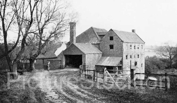
One of the critical factors in the success of the industry in our project area was the construction of the Cleveland Railway, this was opened in November 1861 between the Skelton Old Shaft mines and Normanby Jetty, extending toward Boosbeck in 1862.  Branches were also constructed to Slapewath, Stanghow and Aysdalegate mines.
With the construction of the railways came numerous interesting bridges, tunnels and culverts.

This culvert (in orange) carries a stream under the branch line which went to Slapewath Mine
Culvert under branch to Slapewath
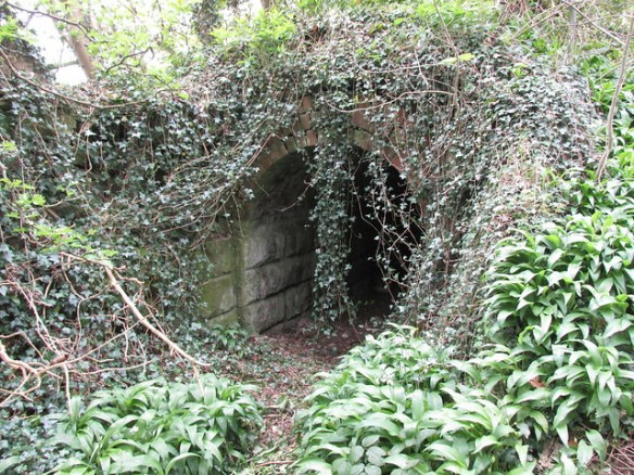
This small tunnel (yellow) went under the same branch line, but was dry for livestock and people to cross under the railway.
Underpass on branch to Slapewath
This much more sizeable tunnel (red) passed under the main line.
Underpass below main line at Slapewath branch
Considering they date from the 1860’s, they are all in excellent condition.

Billingham Beck passing under Railway

Geotag Icon Show on map

This impressive tunnel carries Billingham Beck under what was originally the Clarence Railway.

Billingham Beck

Not sure if this is the original 1830s construction or the bricks are later, there also seems to be a reinforcement or repair a short distance in on concrete.

Norton Water Mill – Tunnel

Geotag Icon Show on map

This tunnel carried the mill race for Norton Water Mill underneath the Clarence Railway embankment  that was built in the early 1830s. The modern railway still passes above.

Mill Race Tunnel, Norton Water Mill.

The mill itself stood about 500m South, now underneath the A19.

Cleveland Railway Embankment – Guisborough

Geotag Icon Show on map

Building work in Guisborough briefly revealed stonework from the original route of the Cleveland Railway which opened in 1861 as a freight line for the local ironstone mines, the original route continued west over a wooden viaduct and skirted the southern edge of the Eston hills.

Capture

In 1865 the Cleveland Railway, Middlesbrough and Guisborough Railway and Stockton and Darlington Railway were all taken over by the North Eastern Railway, the route quickly became redundant and closed in 1873 after only 12 years of use.

20170307_124838_resized

By mid-March the location was lost forever, although this old photo from Guisborough History Notes shows the same abutment

Hutton Hall, Guisborough

Geotag Icon Show on map

Hutton Hall was built in 1866 for Sir Joseph Whitwell Pease, the son of Joseph Pease one of the key players in the Stockton & Darlington Railway
Hutton Hall, Guisborough
Pease became first Baronet of Hutton Lowcross and Pinchinthorpe in 1882.

In 1902 a Bank crash forced the Pease family to sell the Hutton Hall estate, this photo is from the sale catalogue
5-10-49-01-guisborough-jp-front

During the Spanish Civil War the Hall was used to house Basque refugee children.

Stockton and Darlington Railway F10, Barnard Castle

Geotag Icon Show on map

Ceramic tiles were placed on properties owned by the Stockton and Darlington Railway in the late 1850s, early 1860s.
Stockton and Darlington Railway F10, Barnard Castle
The F-Line ran to Barnard Castle and F10 is Barnard Castle crossing.
Stockton and Darlington Railway F10, Barnard Castle

Picton Junction sign at Battersby

Geotag Icon Show on map

The Picton to Battersby Line was constructed 1857/1858 running via Stokesley
Battersby Junction
Passenger services ended in 1954 with freight continuing between Stokesley and Battersby until 1965.
Battersby Junction
Presumably it was 12 miles from this point to Picton Junction.

Battersby Junction, 1907 Water Column

Geotag Icon Show on map

In the days of steam trains, water columns would have been a familiar sight at many stations. The arm would swing out and allow the water in the tender to be topped up.
Battersby Junction, 1907 Water Column

This one dates from 1907 when the line was part of the North Eastern Railway (NER)
Battersby Junction, 1907 Water Column
Its no longer operational and the tank is now full of mud.
Battersby Junction, 1907 Water Column

Albert Bridge, Middlesbrough

Geotag Icon Show on map

The North Eastern Railways chief architect William Peachey designed the Albert Bridge in 1877.
Albert Bridge, Middlesbrough
Over the years it low clearance has peeled many a roof off double-decker buses.
busbus2

Glaisdale Coal Cells / Drops

Geotag Icon Show on map

Glaisdale Station was originally known as ‘Beggars Bridge‘ and opened in 1865
Glaisdale Coal Drops
Station masters were allowed to operate a coal business, providing to the local area. Often making more money from this than their actual job.
Glaisdale Coal Drops
Coal was dropped in from the railway line above, this example being restored in 1986.